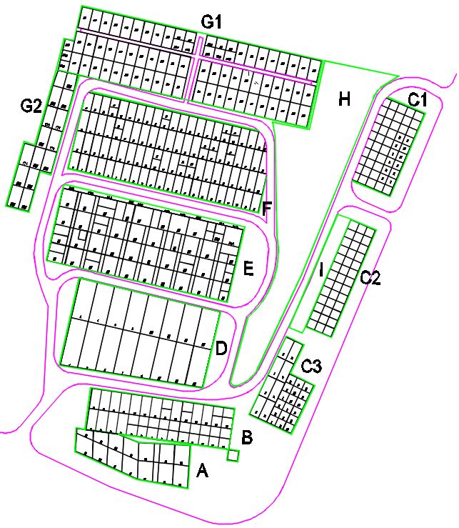
The cemetery plots are divided into sections labeled A through I.
Below are two outlines of the general overview of each section:
1. The first one is an aerial image of the cemetery with each section
superimposed on top.
2. The second is a drawing you can download in
pdf format showing the overview of each section.
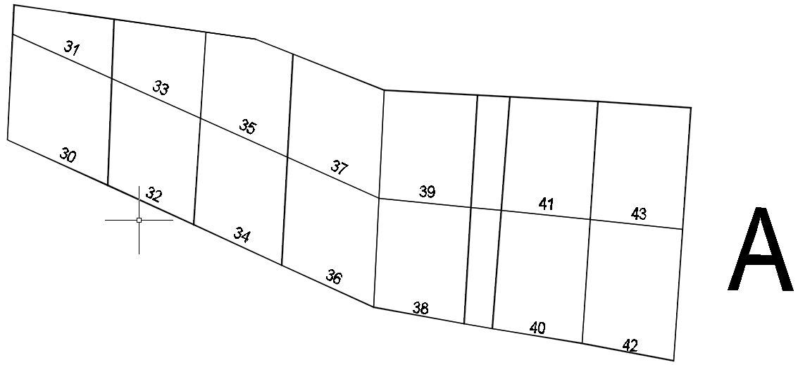
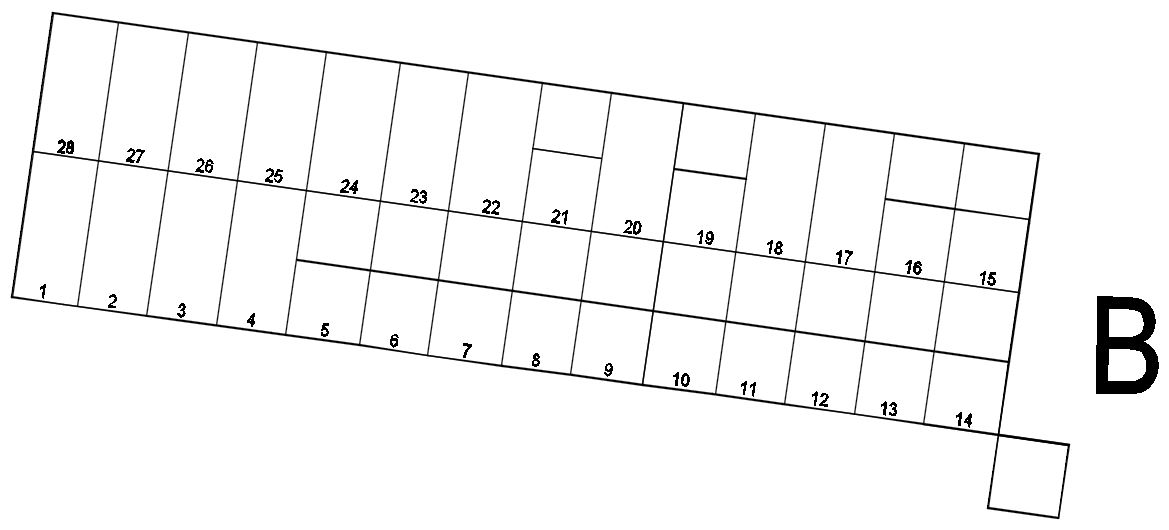
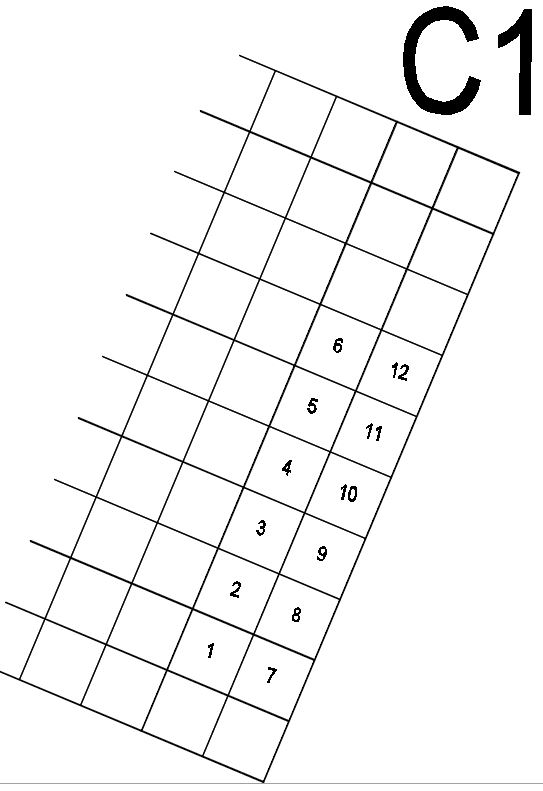
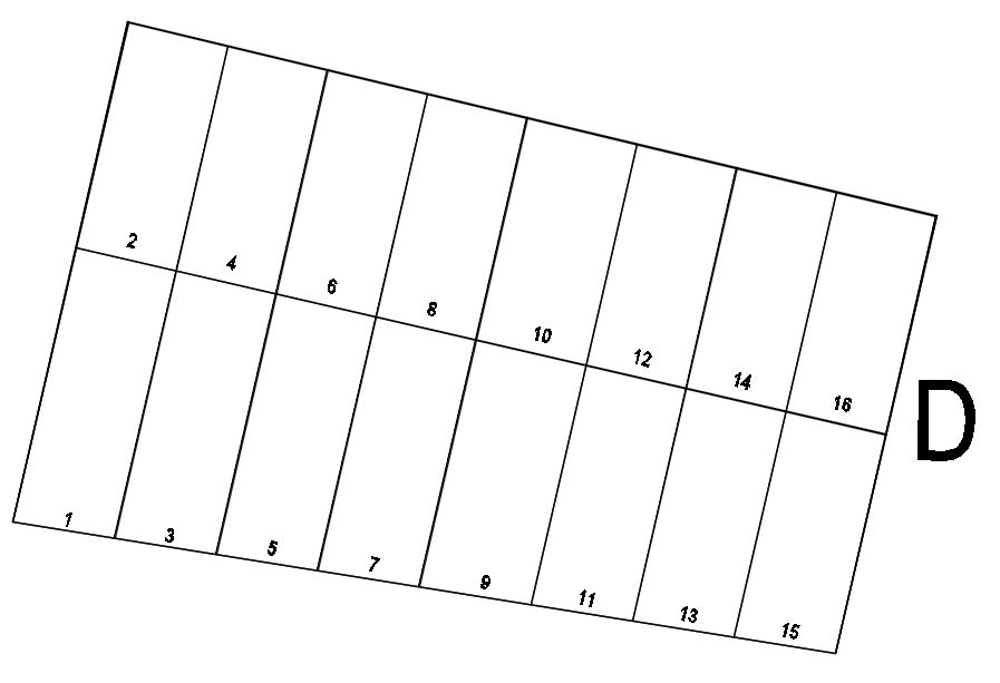
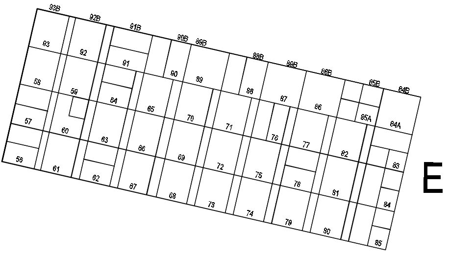
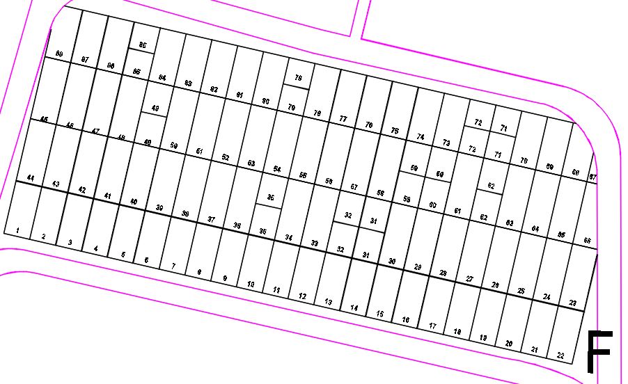
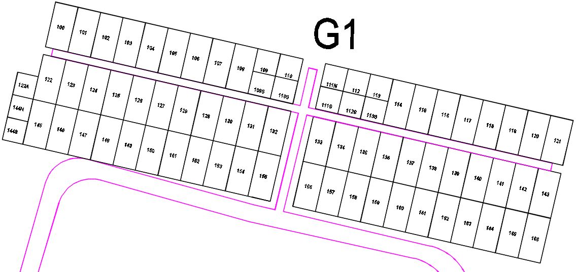
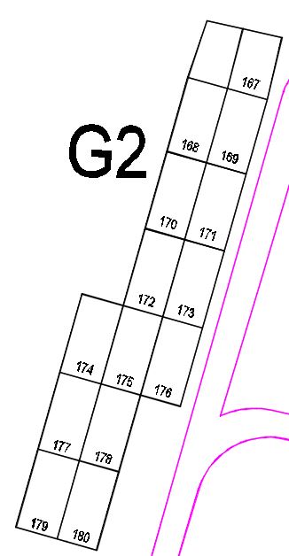
Below these overviews are closeups of each section view showing the individual plot
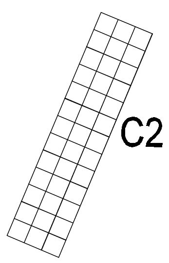
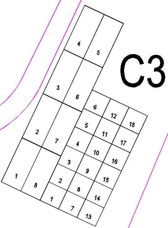
locations. Note that Section C and G have been divided into multiple sub-sections.
These are not labeled this way at the cemetery nor on the burial records. This
was only done to keep the maps more legible and printable. Also note that sections
H and I do not have any plots at this time, so were not included in the detailed map
views below.
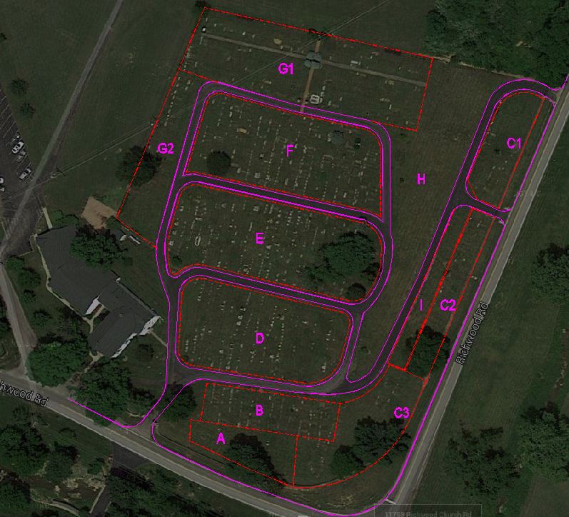
Aerial View of Cemetery Sections
Click here to download a drawing of the
overview of the Cemetery Sections: Gen Plan